Most kids build treehouses or take apart old radios. Dave Hunter built a crude radar setup in his grandfather's shed because he had a very specific problem to solve: finding buried bulls on a rural Victorian farm.
That adolescent garage experiment didn't stay a hobby. Decades later, Hunter runs Hunter Geophysics and spends his time pushing specialized equipment across neglected outback cemeteries. His latest high-profile contract with the Central Darling Shire Council in far-west New South Wales resulted in the staggering discovery of 658 forgotten burial sites across Menindee and White Cliffs. Meanwhile, you can explore similar stories here: Why The F16 Radar Upgrade Program Just Smashed Past Two Billion Dollars.
If you think ground-penetrating radar works like a sci-fi movie scanner picking up glowing skeletons, you've got it backward. The reality of modern geophysics is far more mechanical, and honestly, a lot more interesting.
The Garage Experiment That Sparked a Career
Growing up in Rushworth, northern Victoria, Hunter didn't set out to become a professional locator of lost histories. He just needed to figure out where livestock had been buried on family property. Armed with basic electronics knowledge and a multimeter, he rigged together a makeshift device that could read subterranean anomalies. To understand the bigger picture, we recommend the detailed analysis by MIT Technology Review.
That early curiosity pushed him toward formal archaeology studies at La Trobe University. While there, he built rudimentary geophysical instruments to map out old school foundations and buried gardens hidden beneath Melbourne schoolyards. By 2009, he turned the tinkering into a full-time enterprise.
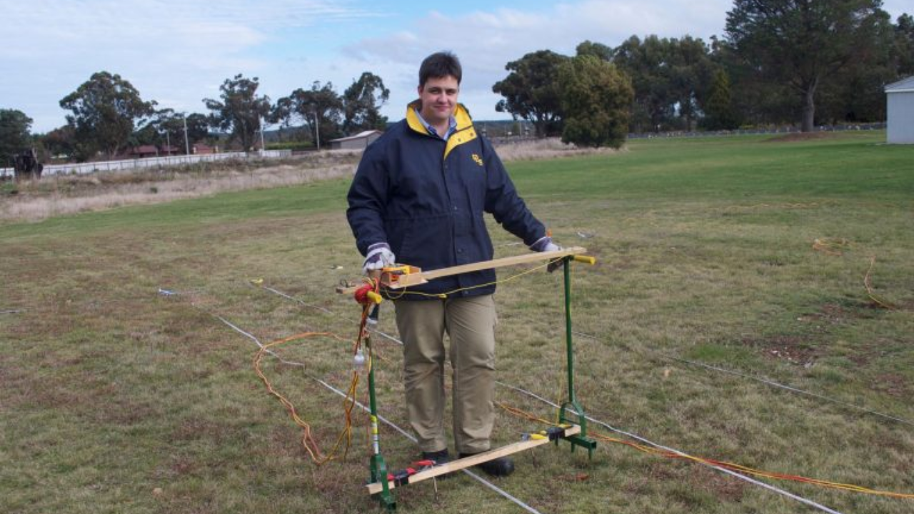
Today, Hunter knocks out 10 to 15 cemetery projects a year. But his gear looks a lot different than the crude multimeters of his youth. He relies on commercial ground-penetrating radar systems that look suspiciously like lawn mowers, wheeling them back and forth over patches of dry earth where local memories have long since faded.
What Ground-Penetrating Radar Actually Sees
Let's clear up a major misconception right away. Radar does not spot bones, hair, or caskets sitting quietly underground.
Instead, the technology targets human disturbance. When someone digs a grave, the soil density changes permanently. Even after the hole is filled, settled, and leveled over decades, the earth retains a different physical signature than the undisturbed soil surrounding it.
The radar unit emits high-frequency radio waves into the ground. These pulses bounce back whenever they hit a shift in soil density, moisture, or material composition. By analyzing the reflected signals on a connected screen, operators map out underground anomalies.
Hunter looks for the precise geometry of a burial pit—its depth, length, and width. If the dimensions match standard grave cuts, it gets flagged. But it's rarely a slam dunk. Interpreting outback soil profiles takes years of hands-on field experience because clay, sand, and rock all distort radar waves differently.
Uncovering Six Hundred Lost Souls in the Outback
The sheer scale of forgotten graves across rural Australia is staggering. Wooden headstones rot away, grass reclaims fenced plots, and parish records vanish during floods or fires. Entire communities disappear from the active map while the dead remain right where they were left.
That reality hit home recently in the outback towns of Menindee and White Cliffs. Local officials needed to map out cemetery boundaries to plan future maintenance and avoid accidental disturbances.
Hunter and his team scanned the dusty plots through intense heat, finishing the field phase by late 2026. The tally came back at 338 unmarked graves in White Cliffs and 320 in Menindee. Over 600 ghosts of local history brought back into the official record without a single shovel touching the dirt.
Council officers like Tammie McMaster now face the arduous task of matching those invisible grids back to historical archives, interviewing elderly residents, and trying to attach real names to numbers on a map. Meanwhile, towns like White Cliffs have erected central memorial markers, giving families a place to grieve ancestors they didn't even know had a lost plot.
Why This Work Matters Right Now
Cemeteries aren't just historical museums; they are active municipal infrastructure. Councils need precise maps to manage space, install irrigation, or expand grounds without accidentally plowing through unmarked burials from the late 19th century.
Beyond logistics, there's a cultural debt involved. Rural towns across Australia are littered with forgotten settler graves, Indigenous burial sites, and paupers' fields that lost their markers decades ago. Non-invasive geophysics allows communities to reclaim their heritage cleanly and respectfully.
The technology has matured past university labs and high-end research grants. It now sits in the back of an outback contractor's vehicle, ready to drive over a patch of dirt and tell you who walked—and stayed—there long before you arrived.