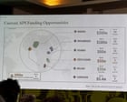
Imagine standing on a global stage representing the United States, pulling up a slide deck about health agreements, and displaying a map of Africa where Nigeria is suddenly marooned deep in the Sahara Desert. That is exactly what happened at the AIDS 2026 conference in Rio de Janeiro, and it turned into an immediate PR disaster.
High-level officials from African nations sat in the audience watching a senior U.S. State Department official present new health memorandum understandings. Instead of respectful diplomacy, they got a geography joke. Every single country on the map was mislabeled. Mozambique was dragged across the continent to the Horn of Africa, the Ivory Coast was completely misplaced, and Cameroon was listed in the text but given zero physical territory on the graphic.
Attendees pulled out their phones instantly. Screenshots flooded platforms like LinkedIn and Substack, courtesy of sharp-eyed experts like AIDS researcher Emily Bass and Atlantic Council analyst Matt Petit.
How the AI Map Mistake Happened
The State Department quickly took full responsibility. Officials explained that a team member hastily swapped out the slide deck right before walking up to present. But a technical analysis by Reuters uncovered something worse. The graphic carried a hidden OpenAI watermark, confirming it was generated using artificial intelligence tools.
You see the danger here. People trust artificial intelligence to spit out quick assets when deadlines loom. Generative tools struggle heavily with complex geographical data sets, often hallucinating labels, borders, and spatial arrangements. When a rushed staffer drops an unvetted AI graphic into a diplomatic presentation, reality bends. Nigeria became landlocked. Lines stretched out from random colored dots, pointing to completely unrelated country shapes.
Why This Goes Beyond a Simple Typo
Mistakes happen in government offices every day. Presentation decks get thrown together under tight pressure. But this blunder hit a raw nerve for several specific reasons.
First, optics matter immensely in international aid and foreign policy. The presentation focused on critical health agreements and HIV programs. Walking into a room full of international delegates to discuss partnerships while failing to map their sovereign nations correctly signals carelessness.
Second, it highlights a blind trust in automated technology. Generative tools save time, but they require human oversight. When nobody checks the output, small shortcuts turn into international embarrassment. Matt Petit pointed out the obvious flaw on social media: whoever approved the slide simply didn't check the work.
What Organizations Must Learn From This Blunder
If you manage communications, public relations, or technical presentations, take note.
- Never trust raw artificial intelligence outputs for specialized data, spatial design, or geography.
- Build a strict verification step into your workflow before any slide deck goes live.
- Respect your audience enough to know basic global geography, especially when negotiating transnational agreements.
The State Department survived the conference, and discussions on global health partnerships continued. Yet the image of a completely scrambled African continent will stick around as a warning for anyone tempted to skip the final review.